
GPR Surveying
Accurate GPR Surveys for Utility Detection
Get a Free Quote From Us Today!
We aim to get back to you in 24 hours.
At GPR Surveying, we specialise in providing professional Ground Penetrating Radar (GPR) surveys for utility detection and subsurface investigation. Our experienced team collects and interprets radar data to identify buried services, structural features, voids, and other anomalies.
We support construction and development projects across the UK, offering detailed insights to enhance site safety and project planning. Contact us today to discover more about our services.
Who Is GPR Surveying?
We’re GPR Surveying, experts in Ground Penetrating Radar surveys aimed at providing precise insights into subsurface conditions. Our experienced team uses advanced radar equipment to locate buried utilities, structural anomalies, and geological features.
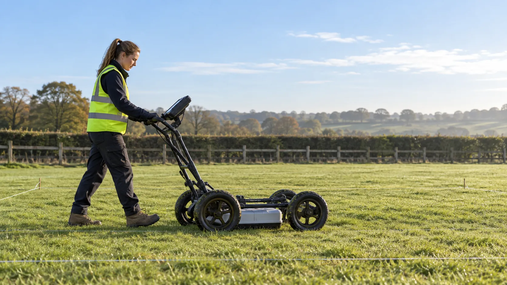
We employ high-frequency antennae to deliver results with centimetre-level accuracy, suitable for varied terrain and conditions. Our equipment is capable of penetrating different surface types, including asphalt, concrete, and soil, revealing anything from pipes and cables to voids and reinforcement bars.
We adhere to industry standards such as PAS 128 for utility detection, ensuring each survey is conducted with professionalism and reliability. With our detailed reports, construction and development teams can proceed with confidence, knowing that potential risks and site conditions are thoroughly evaluated.
We also assist historical site conservation with non-invasive investigation tools. If you need comprehensive subsurface analysis, contact us today.
What GPR Surveying Services Does the company GPR Surveying Provide?
At GPR Surveying, our services encompass a range of utility detection and subsurface investigation techniques, employing the latest technology and methodologies to ensure precise results:
- Ground Penetrating Radar Surveys: We collect and interpret radar data to uncover subsurface anomalies, including voids and changes in material composition, using frequencies between 250 MHz and 1 GHz for various depths and resolutions.
- Utility Detection: Our experts identify the location of buried pipes, cables, and other utilities, using electromagnetic locators calibrated to national standards, ensuring construction projects avoid disruptions and costly damage.
- Structural Investigation: We examine concrete structures for voids and anomalies without damage, using non-destructive methods like impulse response and ultrasonic pulse velocity, essential for assessing structural integrity safely.
- Geological Surveys: Our team assesses subsurface geological conditions, helping to identify soil types, moisture content, and rock formations, which informs decision-making for construction, mining, and environmental projects.
These services equip us to meet diverse client needs, from construction firms to environmental consultants, providing reliable data crucial for planning and development. Contact us to discuss your specific project requirements.
When Is Ground Penetrating Radar Surveying Needed?
GPR surveying is crucial before beginning any excavation or construction work. At GPR Surveying, we recognise the importance of identifying buried utilities, such as electrical cables, gas lines, and water pipes, which, if damaged, can lead to costly repairs and significant project delays.
Our surveys are invaluable for assessing subsurface variations, including soil composition and underground voids, which can affect the stability of structures. Additionally, GPR is used to locate historical artefacts and archaeological sites, helping to preserve cultural heritage during development projects.
For each survey, we use industry-standard equipment like the StructureScan Mini XT, which provides detailed imaging suitable for concrete scanning and utility location. Our expertise supports compliance with construction standards like those set by the British Standards Institution, ensuring your projects meet safety regulations.
By addressing unknown subsurface conditions before work commences, we help clients avoid potential hazards and streamline their construction processes.
Get a Free No Obligation Quotation Today
How Does GPR Surveying Work?
At GPR Surveying, we follow a systematic approach to our surveys to ensure precise and reliable results for a range of clients, including property developers and environmental consultants:
- Consultation: We begin by discussing the project requirements and objectives with our clients, ensuring alignment with their goals.
- Site Assessment: Our team evaluates the site conditions, considering soil type and potential obstructions, to determine the most suitable survey techniques. We adhere to relevant standards such as PAS 128 for utility detection quality levels.
- Data Collection: We deploy ground-penetrating radar (GPR) equipment, which emits electromagnetic waves to capture detailed subsurface images. We use equipment with varying frequency ranges for different depths, ensuring thorough data collection.
- Data Interpretation: Our trained professionals analyse the radar data to identify utilities like gas and water pipelines, as well as subsurface features such as voids or foundation structures.
- Reporting: We deliver a report, including 3D visualisations and GIS maps, with detailed findings and actionable recommendations.
By following this structured method, we help minimise risk and support informed decision-making. For more information or to schedule a consultation, please contact us.
Who Does GPR Surveying Help?
GPR Surveying assists a wide range of clients, including construction and development companies, civil engineers, architects, and utility providers. Our Ground Penetrating Radar technology is particularly beneficial for infrastructure projects such as bridges, tunnels, and railway developments.
We conduct thorough subsurface investigations, offering comprehensive reports that include data on soil composition, void detection, and the location of underground utilities like water pipes, electrical conduits, and fibre optic cables.
Our services adhere to industry standards such as PAS 128, ensuring accuracy and reliability. This means construction managers can make informed decisions, reducing the risk of accidental utility strikes and project delays.
We also work closely with environmental consultants for projects requiring archaeological assessments. By partnering with us, clients gain access to vital subsurface information that shapes successful project outcomes.
Reach out to us to discuss how we can support your specific project needs.
How Quickly Can GPR Surveying Respond?
We understand that timely survey data is essential for our clients’ projects, whether it involves construction, archaeology, or infrastructure maintenance. At GPR Surveying, we typically conduct site surveys within two to three days of initial contact, depending on project size and location.
We use advanced ground-penetrating radar equipment to quickly assess and map subsurface features without disturbing the site. Our team reviews detailed site specifications and coordinates with your engineering or planning teams to ensure all necessary areas are covered.
This preparation allows us to prepare accurate data and reports, adhering to industry standards such as PAS 128. We strive to deliver prompt and precise results to minimise delays and keep your work on track.
Contact us to schedule your survey.
Request a free quote
How Does GPR Surveying Ensure Quality and Compliance?
Quality and compliance are central to our operations at GPR Surveying. We adhere to relevant industry standards such as PAS 128 and BS EN 302, which guide the application and accuracy of Ground Penetrating Radar (GPR) surveys.
Our surveyors are trained in the latest GPR techniques, including advanced signal processing, which enhances data resolution and interpretation.
Regular equipment calibration, performed using industry-standard test targets, ensures our GPR devices, including impulse and continuous wave systems, maintain precision and reliability. Our stringent data analysis protocols involve the use of specialised software to interpret subsurface features accurately.
We work closely with clients to meet specific project requirements and regulatory guidelines, offering detailed reports that include depth, location and material composition of underground utilities. Our clients range from construction companies to environmental agencies, ensuring diverse applications across various sectors.
Contact us to see how we can assist with your specific surveying needs.
Why Choose GPR Surveying?
Our dedication to precision and customer satisfaction makes us the preferred choice for GPR surveys. At GPR Surveying, we offer:
- Expertise: Skilled staff with extensive experience in radar data interpretation. Our team is trained in methods such as time-domain and frequency-domain analysis to provide in-depth insights.
- Advanced Equipment: Using the latest GPR technology, including multi-frequency and multi-channel systems, for accurate results. These systems allow us to detect both shallow and deep subsurface features.
- Comprehensive Reports: Detailed findings are presented in easy-to-understand formats with annotated diagrams and 3D models. This has proven invaluable for construction planning, site evaluation, and ensuring compliance with safety standards.
- Nationwide Service: Ability to undertake projects across the UK, from large urban developments to historic sites, providing solutions for a variety of infrastructure and renovation projects.
Our goal is to deliver reliable and precise results tailored to your specific project needs. Feel free to contact us to discuss how we can assist with your survey requirements.
Frequently Asked Questions
What is Ground Penetrating Radar?
Ground Penetrating Radar (GPR) is a non-invasive method that uses radar pulses to image the subsurface. At GPR Surveying, we use this technology to locate utilities and analyse geological conditions.
How accurate are GPR surveys?
The accuracy of GPR surveys depends on site conditions and the depth of detection. At GPR Surveying, we strive for precise data interpretation, typically achieving detection depths of up to several metres.
What types of projects benefit from GPR surveying?
GPR surveying is beneficial for various projects, including utility mapping, archaeological studies, structural assessments, and environmental investigations. Our services at GPR Surveying provide valuable insights for successful project planning.
Get a Free Quote
For reliable GPR surveys tailored to your project’s needs, contact GPR Surveying. Our team is ready to assist with expert advice and precise subsurface data.
speak with our team today
What People are Saying About Us
★★★★★
“We needed to know what was buried under our yard before resurfacing. GPR Surveying showed every pipe and cable with its depth on a tidy plan. Highly recommended.”
Callum Kaur
London
★★★★★
“Really pleased with the radar survey from GPR Surveying, it was all done quickly and tidily. Would definitely recommend them to others.”
Megan Patel
London
★★★★★
“A friendly, welcoming team at GPR Surveying who made me feel at ease from the start. I was delighted with how everything went.”
Priya Sutherland
London
★★★★★
“Accurate results from GPR Surveying and a really polite, professional operator on site. Very happy.”
Owen Osei
London
Our Locations
We are proud to work nationally across the UK, allowing us to ensure we can provide services to you.
For a full list of counties we cover in the UK, see below.